Written by Alyssa Stoller (Whale Wise) and Hugh Francis Anderson
Field research has one constant variable, and that is unpredictability. Data collection can often become limited or stopped completely due to bad weather or lack of encounters with species of focus. Luckily, the Arctic Sense expedition thus far has been able to successfully deploy the towed-hydrophone during many transits of the expedition, deploy and retrieve a sound-trap that recorded the acoustic environment for about a month off southern Svalbard, capture aerial and identification images of endangered blue whales (as well as other cetacean species), document changes/pollution in the remote Arctic and sail as far North as possible.
The research, however, does not end with Svalbard, but will carry on throughout the rest of the expedition. During the transit to Svalbard and circumnavigation of Jan Mayen, data collection will continue on land and at sea.
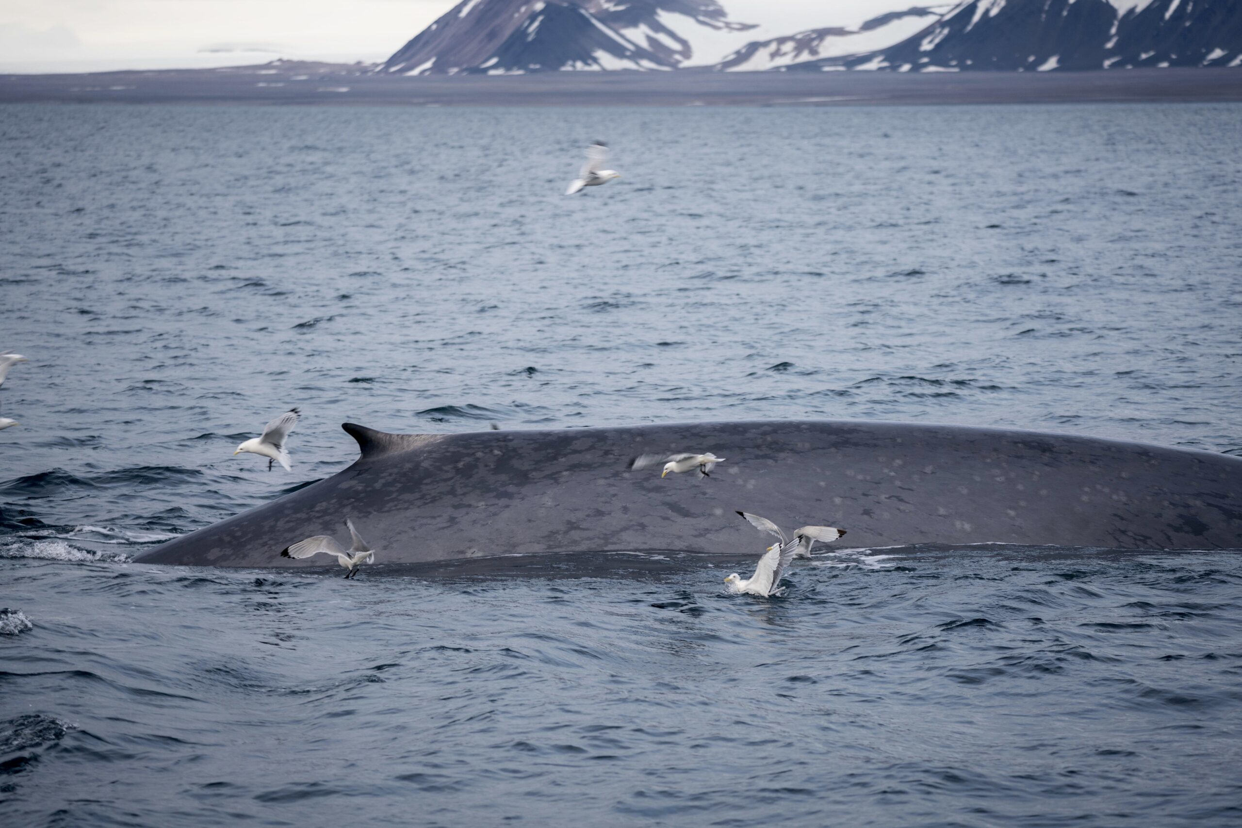
Photo by Giulia Ercoletti. Blue whale individuals can be identified by the shape of their dorsal fin, scars and the mottled pattern of their flank.
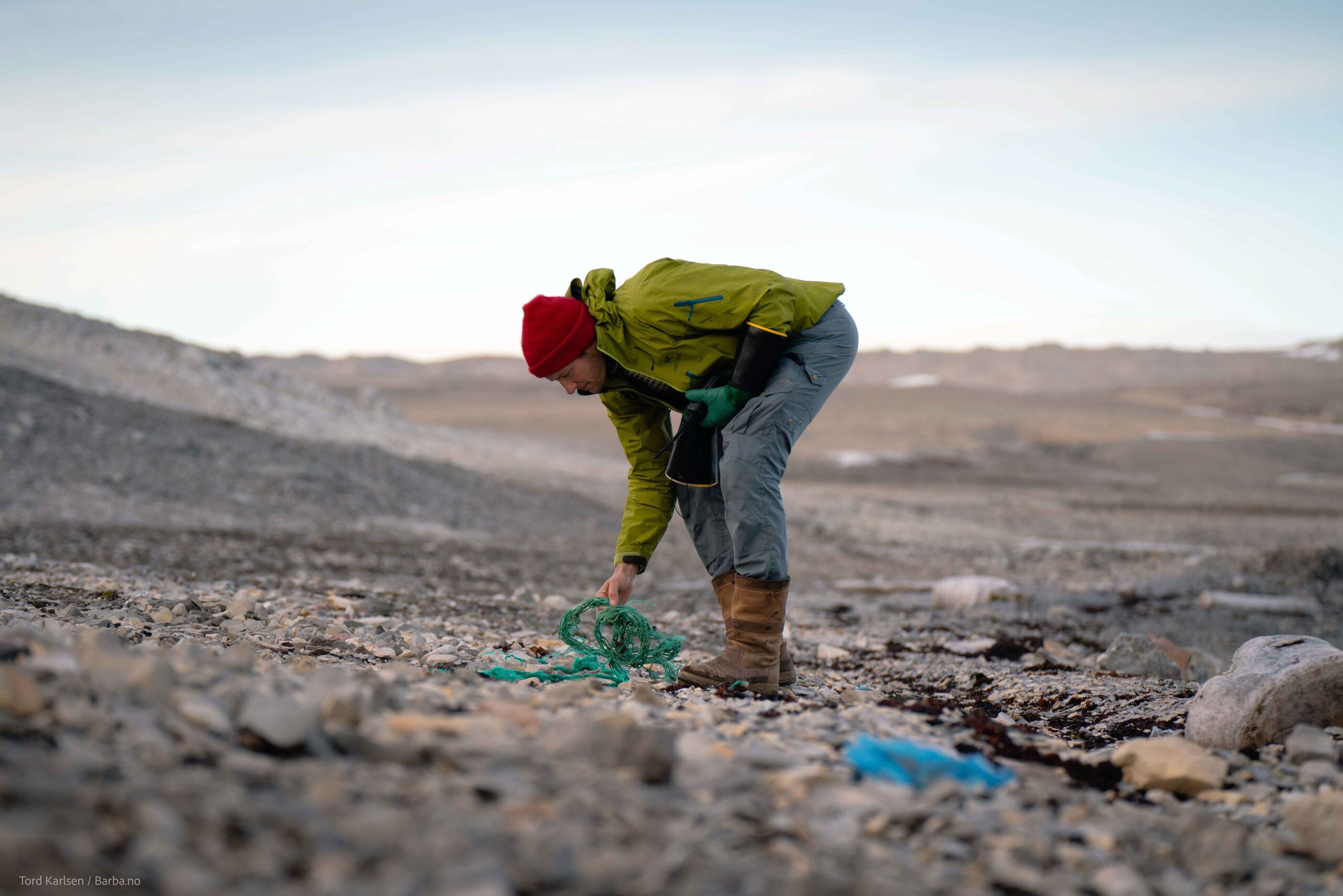
Photo by Tord Karlsen. Andreas picking up fishing line from the remote coastline of northern Svalbard.
Jan Mayen ocean-based research
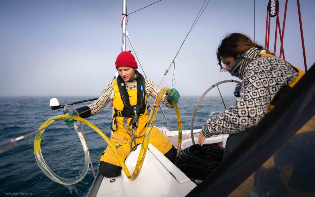
The waters between Svalbard and Jan Mayen to a large extent are still relatively unexplored. This means that gathering baseline data, just discovering what is there in the first place, is extremely important. One of the best methods of doing this when it comes to cetacean (whale) research, is by using a towed-hydrophone array. These hydrophones allow you to record the underwater soundscape while in transit, including whale and dolphin vocalizations. This is an excellent method of recording deep-diving species like northern bottlenose and sperm whales, that might be heard, but rarely seen. While transiting to Jan Mayen the crew was able to deploy the hydrophone for long periods of time, collecting invaluable data. These deployments will continue during the circumnavigation of Jan Mayen, where the team is hoping to record northern bottlenose whales, an allusive beaked whale species.
Additionally, the crew hopes to deploy a HydroMoth (a small hydrophone created by Open Acoustic Devices) in the shallow waters (<30 meters) off Jan Mayen. This is largely experimental, but this hydrophone has the chance of recording baleen whale species around Jan Mayen. After the circumnavigation, Andreas would recover the Hydromoth via SCUBA.
Although one of the oldest methods of whale research, it is still one of the most important. Photo identification of whales is used by taking a picture of either the fluke, dorsal fin or flank of a species in order to identify it by individual. By doing this, we can match individual whales to different locations and thus discover how breeding/feeding grounds are connected and infer possible migration patterns. Information about orcas and northern bottlenose whales found around Jan Mayen is especially limited. Therefore, a simple image of these animals can go a long way scientifically. For this reason alone, Barba can make large research contributions by traveling to these remote and relatively unstudied locations.
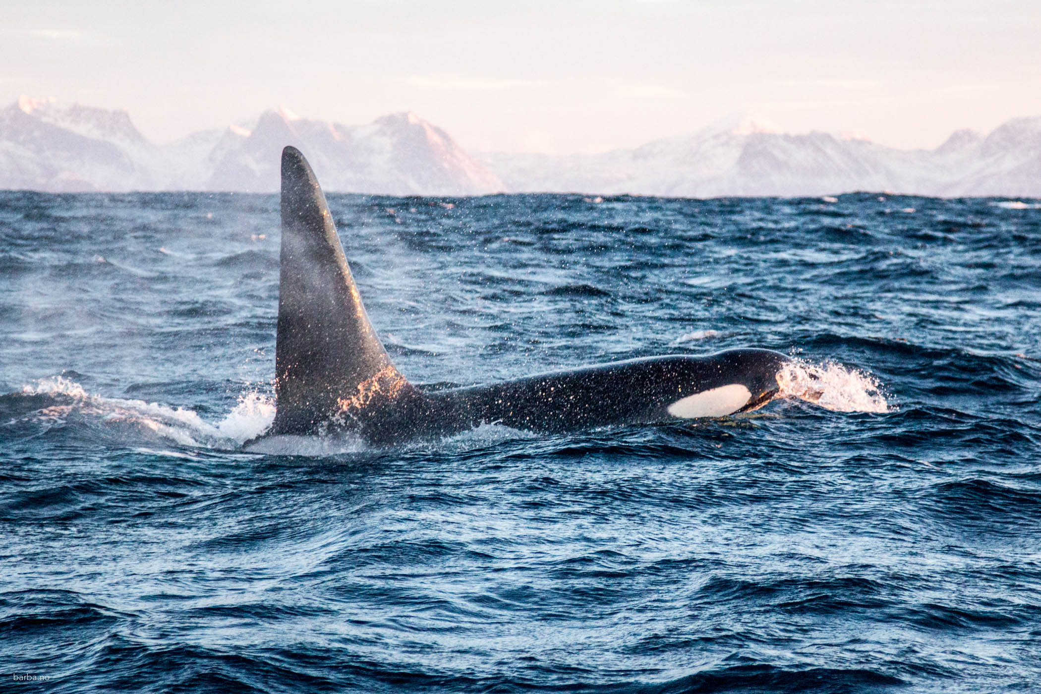
Photo by Andreas B. Heide. Orcas can be identified by their dorsal fin shape, scars and nicks, as well as the grey saddle patch found below the dorsal fin.
Furthermore, the team will continue to collect aerial images of large baleen whales via drone. By collecting these images we can assess the length and width of individual whales, using this information to estimate age and overall health (basically how fat the whale is).
Jan Mayen land-based research
The north of Jan Mayen is dominated by the glacier-covered volcano Mount Beerenberg. When the team undertakes the summit attempt, they will follow the exact route used by the Wordie party in 1921. In doing so, they will cross reference the original expedition report with their own findings to document the level of glacial retreat and degradation to discover whether the original route is still passable today.
They have also partnered with the collaborative research group Deep Purple, which is currently investigating the physical and microbial darkening of Greenland’s ice sheets. The team will collect snow and ice samples at regular intervals along the climb, which Deep Purple will assess under an electron microscope to unearth levels of black carbon and snow & ice algae from Jan Mayen’s South Glacier. This will be the first-time Jan Mayen’s glaciers have been tested for black carbon and algal blooms. The findings may help establish the rate at which the South Glacier is retreating due to physical and microbial darkening.
![]()
![]()
![]()
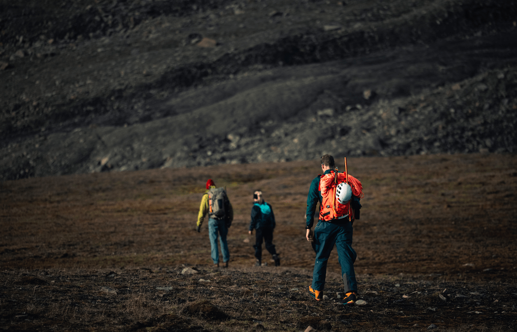
Photo by Hugo Pettit. The team training for the Mt. Beerenberg climb in Svalbard.
Featured photo by Tord Karlsen. Andreas and Giulia deploying the towed-hydrophone array.
