
Arctic Sense Leg 2: Tromsø to Svalbard, Part 1 (Bjørnøya). Eivind Egeland Olsen shares his thoughts on the crossing to Bjørnøya.
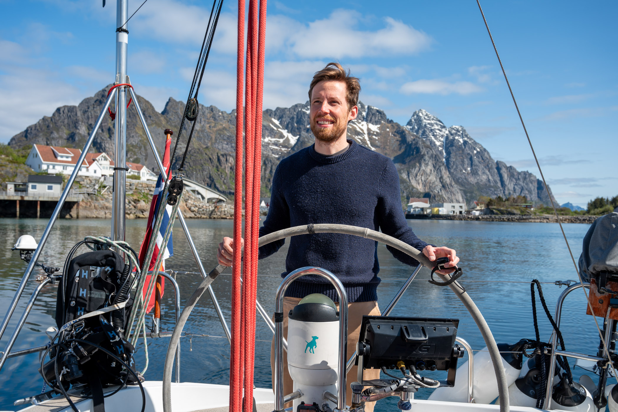
After a successful first leg of the Arctic Sense expedition up the Norwegian coast, and a few rest and prep days in Tromsø, we were ready for the next leg to Longyearbyen. We had dropped off our navigation guru, Kristian Nygård, in Ålesund and picked up the Barba ambassador and talented photographer, Tord Karlsen, in Henningsvær. In Tromsø we were again joined by fellow first-time crewmember and Barba Foundation board director, Amalie Kivijärvi, who together with Tord, our captain Andreas Heide, Tawanda Chikasha, and me, now made up the crew. If we were short any Arctic sailing experience, we more than made up for it in high spirits – onwards to Svalbard!

Although I grew up by the sea and have spent many summers on the water in the archipelago around Stavanger, I was new to sailing, and certainly to open-ocean crossings. For me, this crossing was first just a crazy idea as I was only scheduled to join the expedition from Stavanger to Tromsø, which also came about by coincidence, over lunch with Andreas earlier this year. Andreas and I go some way back – we first met at university in Bergen and have since crossed paths on occasion through shared friends. The most memorable perhaps at a wedding in New Mexico. At the time, I was not aware how far out of his natural element he was in that high and arid desert environment! I have since come to learn about his passion for the ocean, and over lunch he laid out his plans for the Barba Foundation, which impressed me, and I saw that I could bring some complementary experience and network to the project. What better way to kick things off than to spend two weeks on a small boat sailing to Tromsø! When that leg came to an end, I was a more experienced sailor (thanks to the Kristian, Andreas and Tawanda!) and luckily there was a free half of the starboard aft cabin. I also like to think the others enjoyed my company (and cooking perhaps!), but you will have to get that from them.
Personally, this felt like a blessing. For the last five years, and on and off since the start of my career, I have worked with funding technology companies that contribute to mitigating climate change. Despite worrying signals during this entire time and perhaps during my entire lifetime, not enough has been done to mitigate global warming, not by many nautical miles. During the last couple of years there has indeed been an acceleration of efforts, but the same can be said of dire reports on the results of previous ones. Even during our expedition, there seemed to be daily news on shattering records we absolutely don’t want to break. No place is this trend clearer than on Svalbard, where average temperatures are rising three times faster than the global average. I wanted to see this with my own eyes, perhaps hoping to find that things aren’t as bad as I feared, perhaps looking for motivation in a sea of bad news, or sadly just wanting to experience it all before it’s too late. As you will read, I found a remarkable place, one worth fighting for, and in its honour and hopefully so that my motivation rubs off, I will focus on the positively extraordinary. I hope you will take my words as a soft spoken call to action.
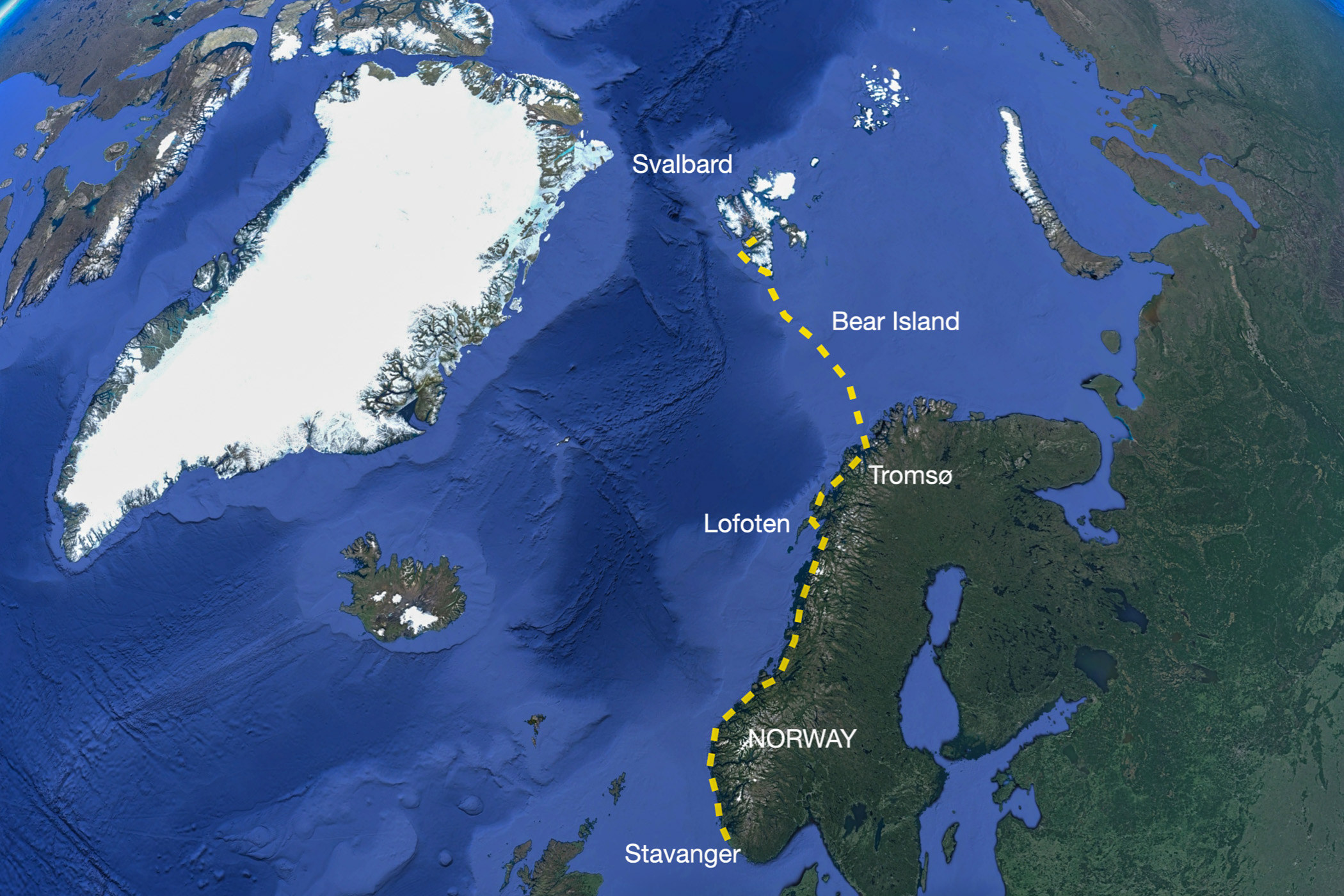
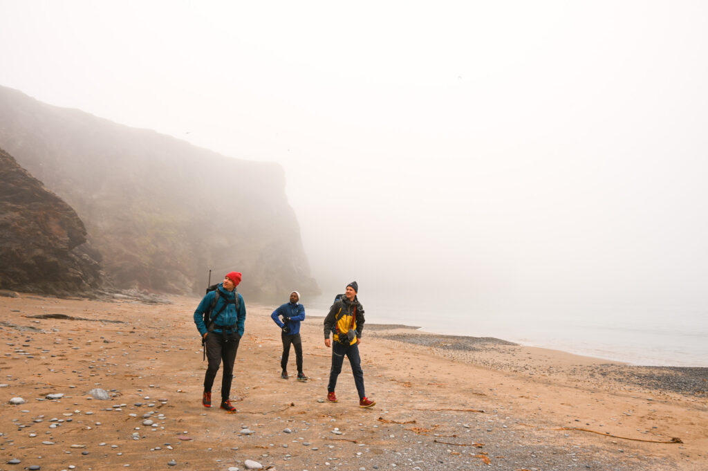
The plan was to sail for four to five days up to Svalbard, including some time at anchor on Bjørnøya, a tiny island roughly halfway between mainland Norway and the southern tip of Spitsbergen, inhabited by only nine people currently working at the metrological station at the north of the island. After arriving at Spitsbergen, we would spend another four days reaching Longyearbyen, including two nights at anchor along the way. For three of the crew this would be the final destination of this adventure, for now at least.
The weather forecast was mostly calm and sunny, with winds expected to pick up somewhat underway and give good downwind conditions. This meant a smooth start, but also that we needed to stock up on fuel to make sure we could reach Longyearbyen safely and on schedule even in low wind conditions. I feel somewhat disheartened that we still rely on fossil fuels for an expedition of this nature but take comfort in the fact that marine transport is receiving increased attention and funding to accelerate the technological shift to low- and zero-emission solutions, which hopefully will be readily available for both small and large ships in the not-too-distant future.
This trip has certainly given me food for thought in relation to the energy transition, as we have sailed through some of the most contentious areas for future oil and gas exploration. Conversely, we have seen the visible footprint of renewable alternatives, such as large wind farms on the pristine Arctic coastline, and how rapid growth in salmon farming (a low-carbon animal protein source) has peppered fjords with circular net pens and adversely impacted local ecosystems. Coincidentally with our expedition, the Norwegian parliament announced that it will open an area of the Greenland and Barents sea to seabed mining of much needed minerals for the energy transition.
There are undoubtedly difficult decisions to be made on the way forward for humanity on this planet with its finite resources, and inevitable trade-offs, like that between mitigating global climate change and protecting local ecosystems. Luckily, for the latter, the world is waking up to the alarming and rapid loss of biodiversity. Still, considering these trade-offs, it seems that not enough emphasis is put on energy and resource efficiency and the much-but-sadly-only-talked-about circular economy. We are in this (potentially) fatal conundrum because the developed world has over-consumed and done so free of charge by disregarding its negative externalities. Thus, a meaningful part of the solution must be smarter, more efficient and in many cases lower resource use, not relying (largely) on new ways to maintain flagrant consumption. The latter to me is fool’s gold (or minerals if you will).
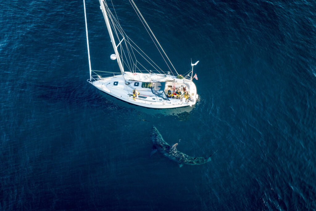
On the more cheerful side, calm seas give excellent conditions for spotting marine life, and for us, the fortunate opportunity to study and document how extraordinary wildlife is coping with the extraordinary challenges imposed on them. And sure enough, we soon had our first extraordinary encounter!
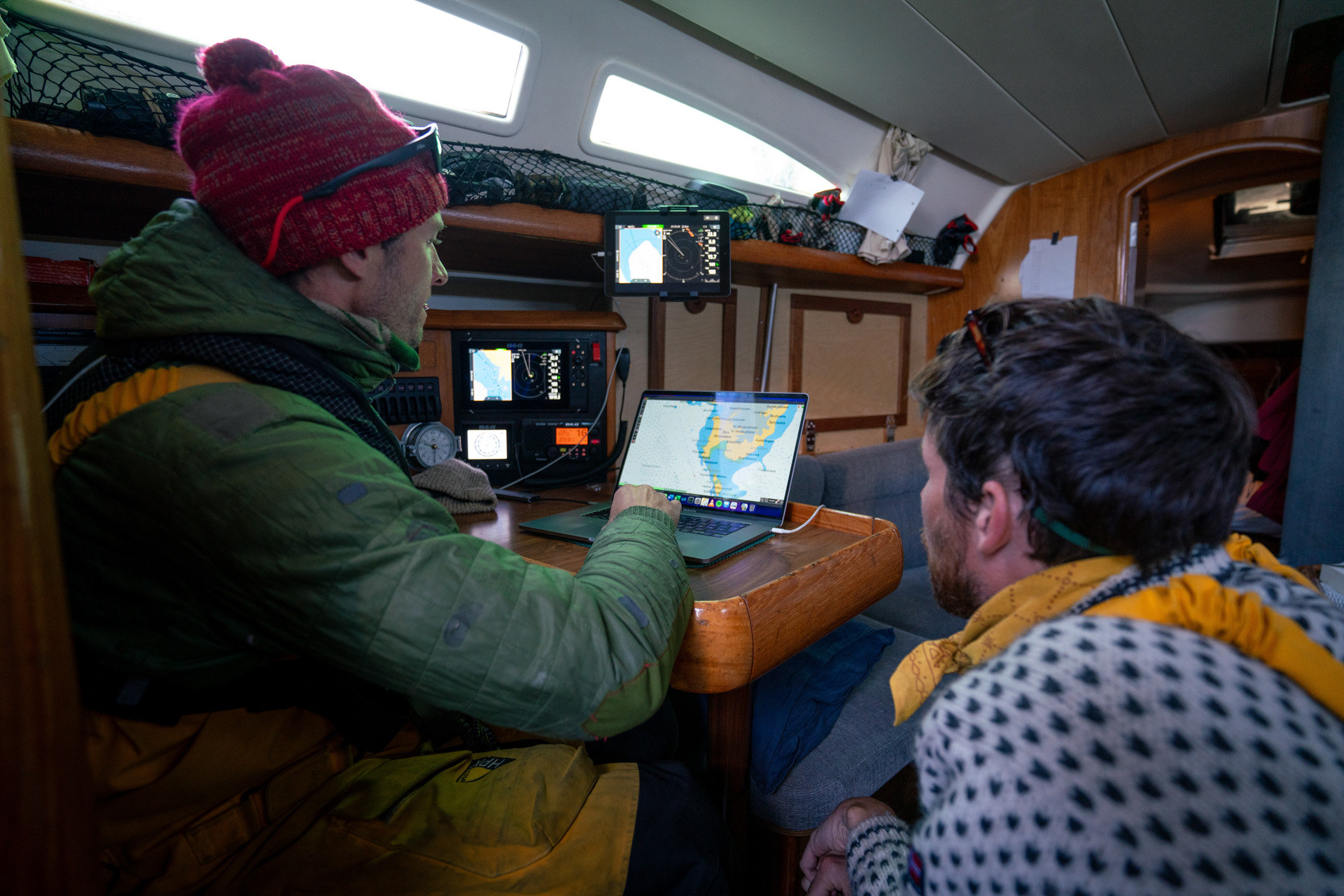
We will get to that, but first, to chart the journey, we continued up the coast between Karlsøy and Gjervøy and passed Nord-Fugløya to the north at around 5am on day two as the last patch of land before Bjørnøya. It was a beautiful Arctic night (or early morning; you can never really tell this far north) with high mackerel clouds mirrored in a glassy sea with only a few tiny ripples. The midnight sun seemed undecided on whether to rise or set, a condition I imagine must have inspired and agonized a great many painters trying to capture its illusive beauty as it spreads low across the rugged northern terrain. This hour also marked the end of my watch, and time for some counterintuitive shuteye.
When I woke, it was still calm, and we were cruising comfortably along. Not much to report apart from the blessed company of several pods of dolphins or “springere” as they are called in Norway (“runners” directly translated to English), for how they characteristically swim playfully ahead of the boat. In our case, we were accompanied by white-beaked dolphins, by far the most common in these waters. You can easily tell that these are intelligent, empathic animals, and I was surprised by how they would tilt to the side and look up when they passed you in the bow, perhaps giving you a cheeky wink. I think I speak for both when I say we enjoyed each other’s company!
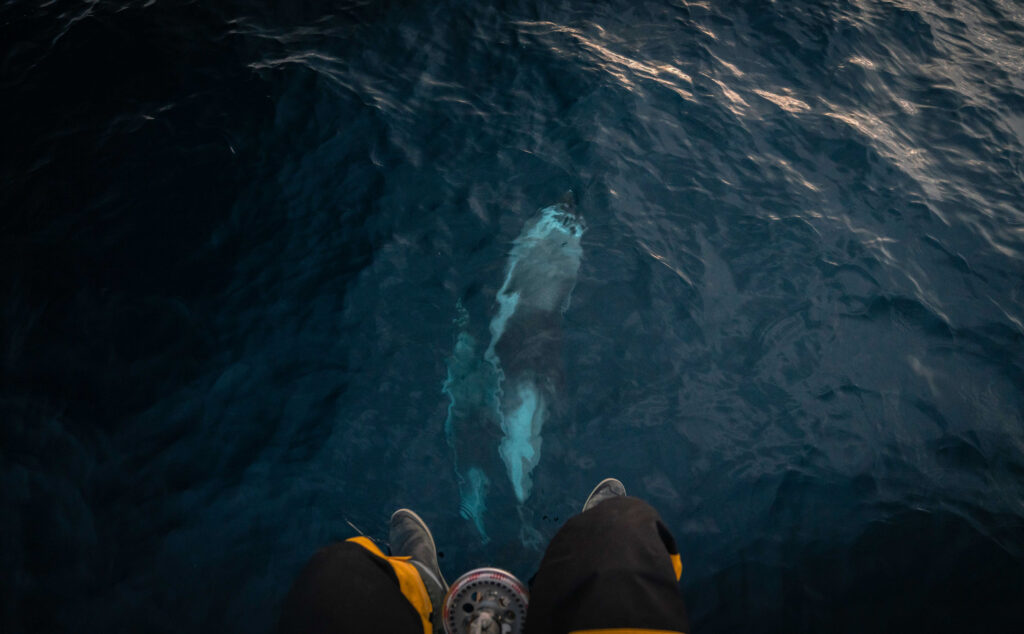
Then, as if out of nowhere, Andreas spotted a much larger dorsal fin in the water some hundred meters away, and quickly exclaimed that it must be the illusive basking shark – the world’s second largest fish, and surely as it edged closer, only a few meters from the boat at the closest, we saw its characteristically open and cavernous jaw. True to its name, it lay basking at the sunny surface next to our boat for several minutes – a truly impressive and humbling sight! We said farewell to our usually reserved friend and vowed to one day see each other again.
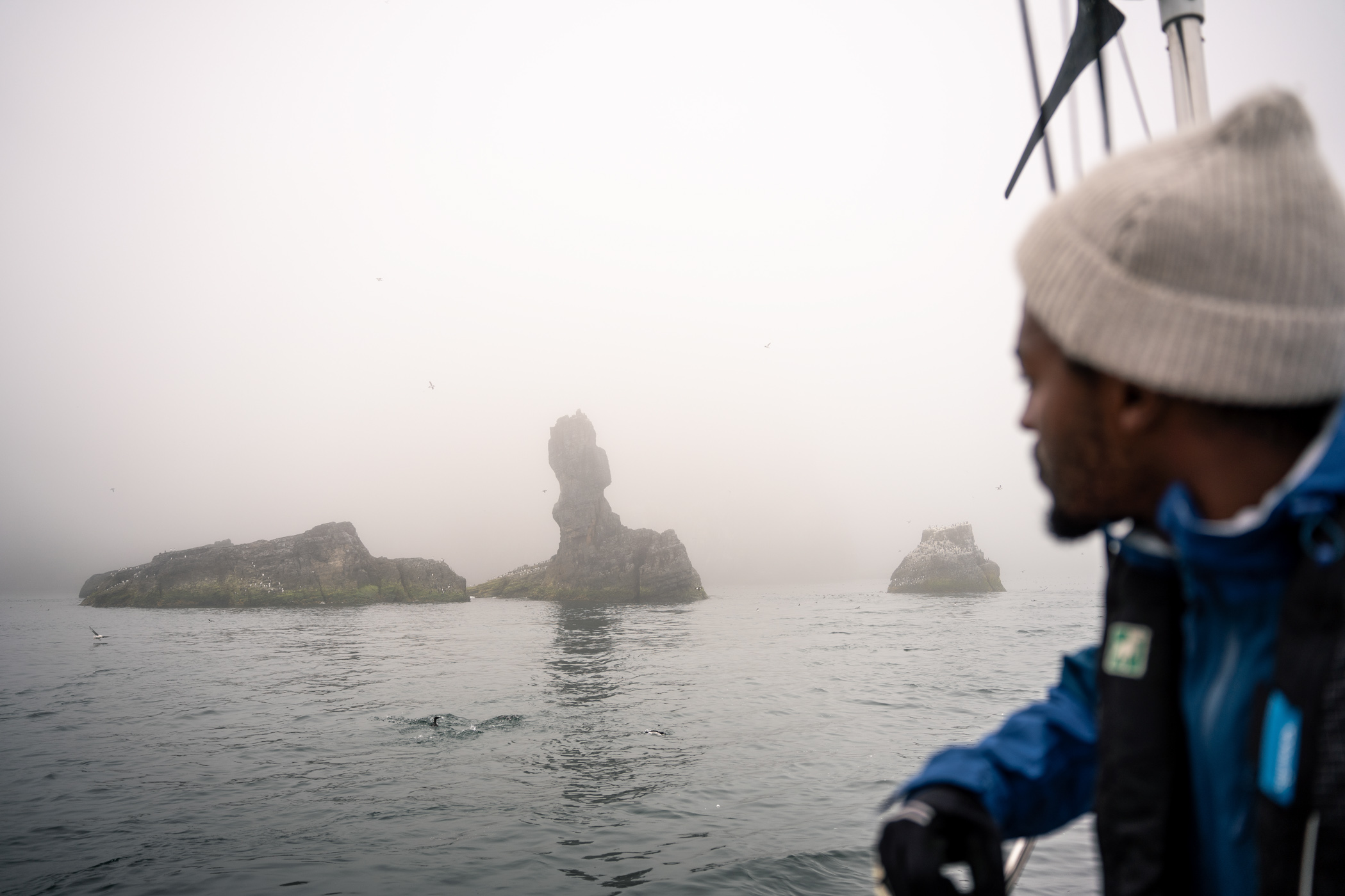
Later, just as the basking shark had, the fog made a sudden appearance and cloaked us in its hazy veil all the way to Bjørnøya.
I must admit that my knowledge of Bjørnøya prior to this expedition was foggy at best. To me it was a strange and lonely dot on the map, jumbled with an odd story, some spread references, and a welcome opportunity to anchor for a few hours if the seas turned rough. However, my expectations and excitement grew considerably as I read up during the crossing, but no amount of desktop research could prepare me for what we had in store!
As we passed its southern tip to the west, the fog finally started to lift and we could see several rock spires jut up from the sea with fitting names such as “Stappen” and “Sylen”, carved by force and time through the erosion of dolomite rock. They are reminiscent of the familiar buttes from the desert landscape of old Western movies and as such, visible indications of the massive canyon-like landscape that exists below the surface, far deeper than the tallest mountain peak, grander than the grandest canyon, and certainly more remote than anywhere that can be reached by foot or horse. It is mind-boggling how little we know about the world below.
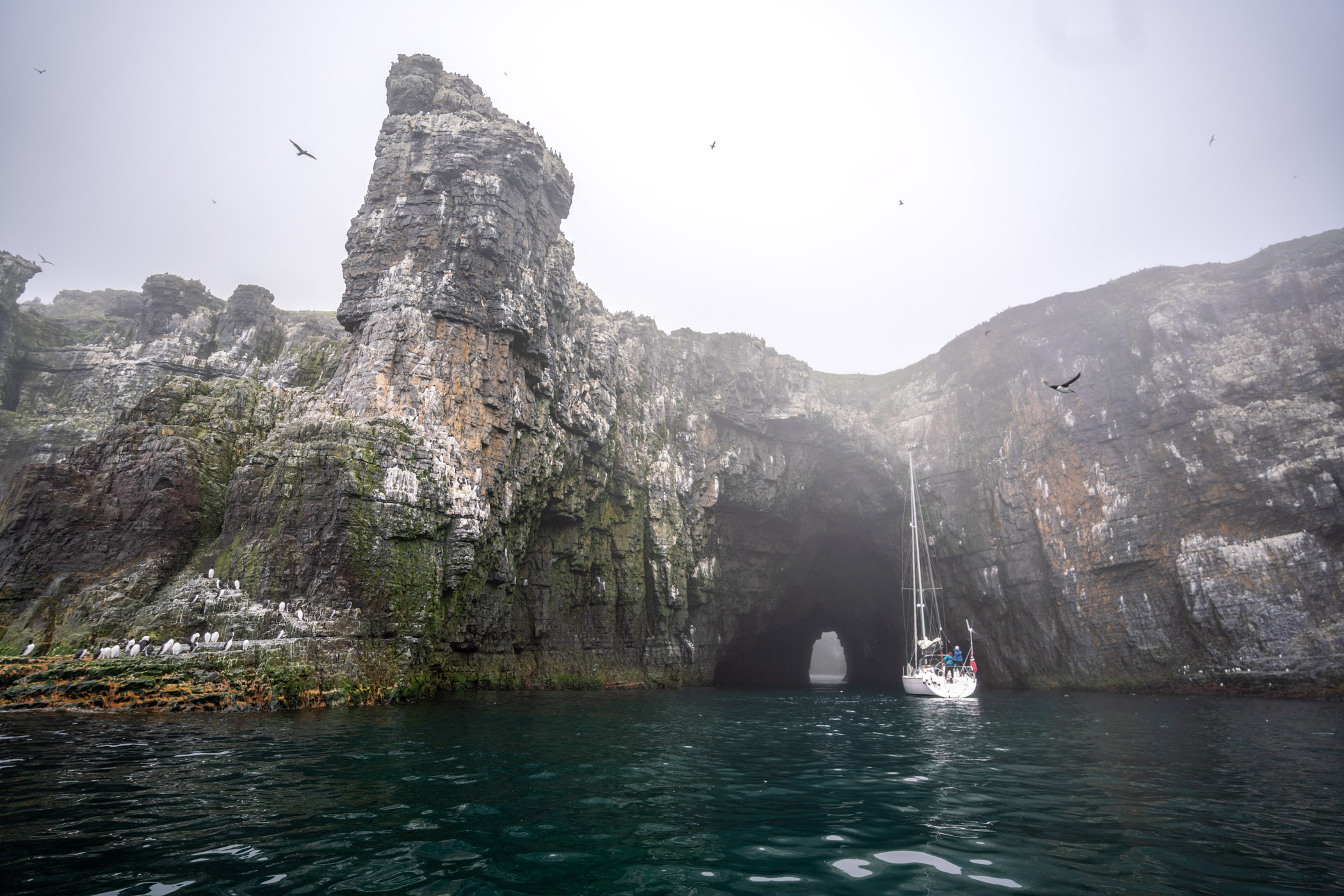
As if in another movie, we shortly after arrived at the “Pearly Gate”, a natural tunnel carved out of the cliff, revealing a sandy, shallow and green lagune on the other side, some 100 meters through solid rock. Thousands of sea birds have made the surrounding cliffs their home as Bjørnøya is the main breeding ground for many Arctic seabirds, and at this particular site to a large colony of Common Murres or Guillemots (in Norwegian “Lomvi”). They lay one egg each directly on the cliff ledges, pear-shaped to prevent rolling, and form crowded colonies to protect against predators. However, even at the “Pearly Gate” the Murres are not freed from the threat of the Glaucous Gull (to be fair its Norwegian name “Polarmåke” sounds less frightening). If tragedy strikes, the Murre may lay another egg, and the high decibel action is a constant reminder of the harsh reality that is the way of life in this astonishing ecosystem. As we passed even more diving Murres, we noticed that every other bird had what looked like elegant monocles around their eyes. In Norwegian this sophisticated half are called “Ringvi”.
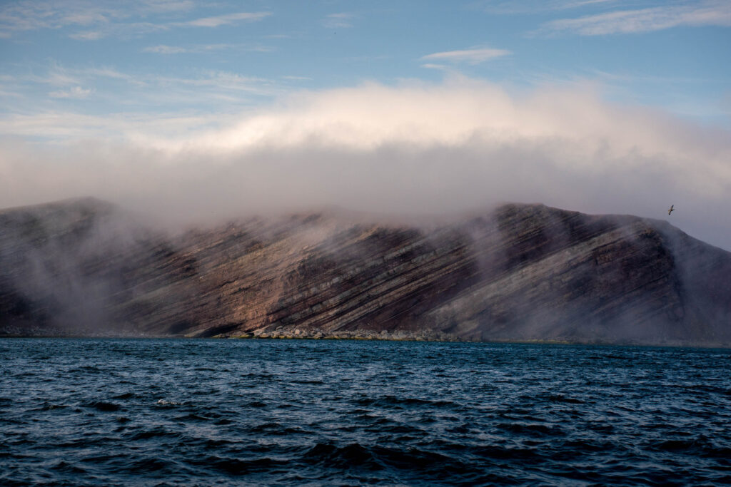
As we leave the “Pearly Gate” the fog is again at its thickest and now we only know land is just off our starboard side. Then, it lifts again as by the jerk of a magician’s cape to reveal an incredible sight of a 400-meter vertical cube-like cliff towering above the turquoise sea. Its massive walls showcase layers of sedimentary rock that make up this unique geology in what could be a cubist masterpiece. Some of the rocks are prone to erosion that by luck or good fortune have created ideal ledges for nesting birds. Further north we pass a section of red sandstone layered diagonally by grey limestone as if the cliffs were painted in beautiful, broad brushstrokes.
This tiny island has so much to share, and I feel blessed to have seen only a fraction of it. That’s the real beauty of nature – it only ever offers a glimpse, as if to say that’s all you can handle. In all its grandness, that is nature’s grand lesson. Reluctant to listen, mankind may have chewed off more than we can handle.
As we anchor up for the night I look straight into the Whale’s Jaw, a natural bridge stretching out westward so that inside its wide-open jaw, in the Arctic Ocean somewhere, lies another wild and wonderful island, waiting for us. That night though, and for many nights to come, I dream of Bjørnøya.
Sources:
- The Norwegian Polar Institute is a great resource for everything Arctic: www.npolar.no
- The meteorological station has a useful website on Bjørnøya (in Norwegian): www.bjornoya.org
- At the stellar bookshop, Norli Bokhuset Tromsø, I was recommended several titles, among them “The Arctic Guide: Wildlife of the Far North” by Sharon Chester and the brilliant “Havboka” by Morten A. Strøksnes, which have provided inspiration and insight long after the crossing.
