Written by Tom Grove and Alyssa Stoller
In collaboration with Barba and various partners, Whale Wise has organised the research programme for Arctic Sense. Whale Wise began working with the Barba team back in 2019 for the Arctic Whale project in Iceland. Together, they used UAV (drones) to collect blow samples and aerial images from humpback whales.
As Barba nears Svalbard, the main focus of the expedition, an incredible two months of research lies just over the horizon.
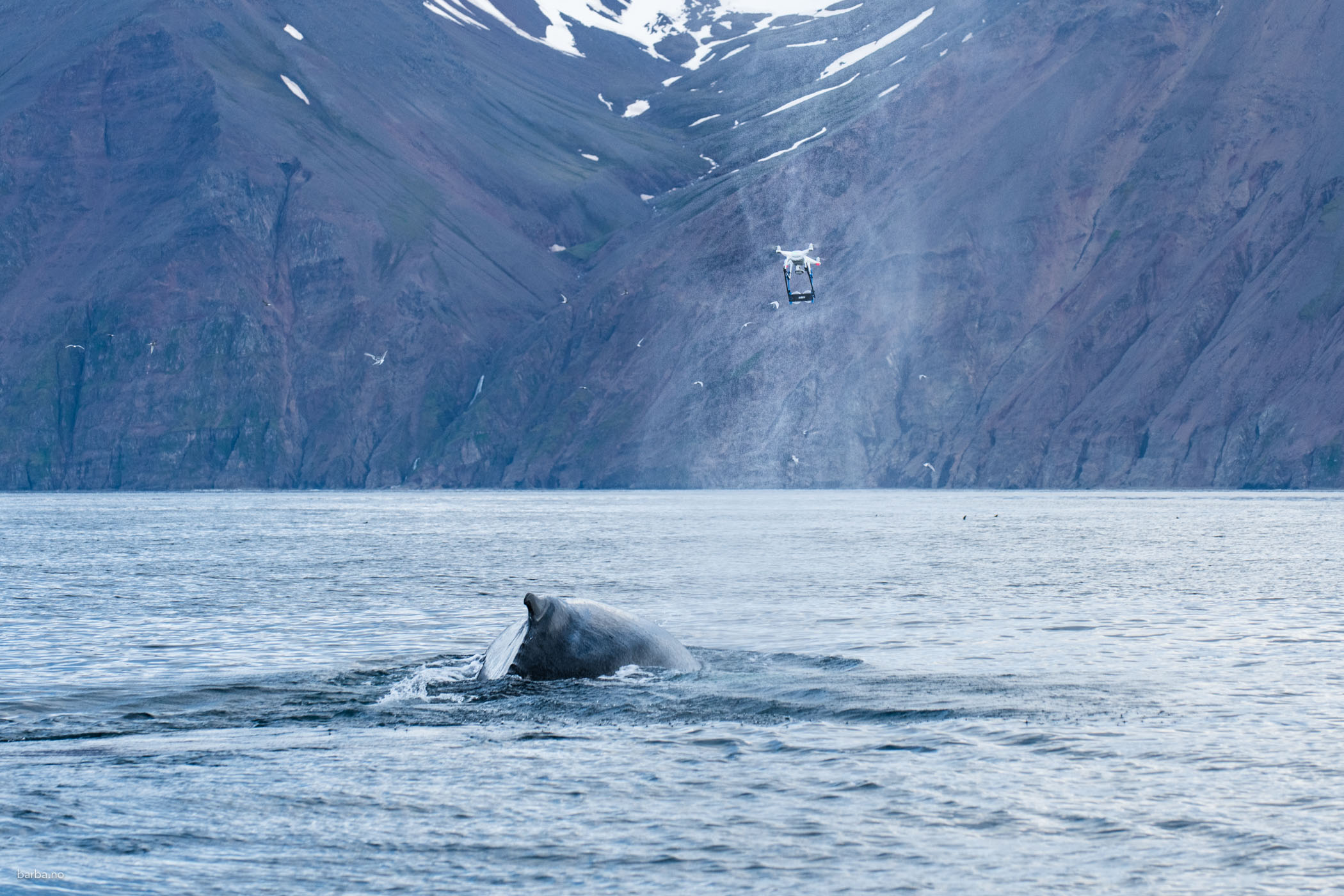
DJI Phantom drone flying through the blow of a humpback whale. Photo by Peter Svanberg.
The challenge
Nestled northward of 76 degrees, Svalbard is an archipelago of remarkable contrasts. Despite bleak scenes of ice caps, bare mountains and jagged coastlines, its coastal waters form one of the most world’s most biologically productive areas in summer. Plankton blooms are the pillar for epic shoals of krill and fish, providing key food sources for North Atlantic baleen whales. Following unparalleled exploitation by commercial whalers until the mid-20th Century, many populations are now recovering, with numbers increasing each year – blue, fin and humpback whales, to name a few.
These good news stories are a cause for celebration and hope, but to stop there would leave the full saga untold.
As we all know, the Arctic is rapidly changing and Svalbard is no exception from the positive feedback loop of our human footprint. Climate change is wreaking fundamental change to Arctic ecosystems; food chains are already shifting and tipping points to entirely new ecological regimes are drawing near. Melting sea ice is also leaving the high Arctic increasing defenceless from our exploitative interests and accessible to our transport. Shipping, mining and commercial fishing are poised to grow exponentially.
This is particularly important because of the incidental nature of Earth’s geography. For humans, our two global trade hubs lie along the Atlantic and Pacific coasts. Transporting vast quantities of goods between the two oceans is far more efficient by boat than air or land. The one problem is the distance, with continental landmasses forcing the construction of the Suez and Panama canals to reduce transport times and cost. As sea ice melts, the Arctic Ocean presents a far shorter alternative, reducing travel time by up to 40%. This cuts CO2 emissions from a carbon-hungry industry when it’s really needed. Unsurprisingly, there is huge interest from nationals and MNCs alike, with large vessels already testing the route.
But at what cost?
Arctic ecosystems are racing towards a precipice, whose form we cannot yet predict, driven by climate-induced oceanographic shifts. For many animals, particularly marine mammals, the predicted explosion in large vessel traffic represents an enormous stressor. The Arctic soundscape is rich in biological acoustics, crucial to whale communication and very fragile. Vessel noise is already known to whale hinder communication and feeding, and its impacts are likely heightened in the Arctic. Beyond noise, ships and associated port construction physically alter habitats and introduce major sources of chemical pollution. In a far more direct way, ship strikes may kill hundreds of whales each year. If we value whale populations (discussion for another blog!), there is a clear need to minimise these impacts before they grow too large.
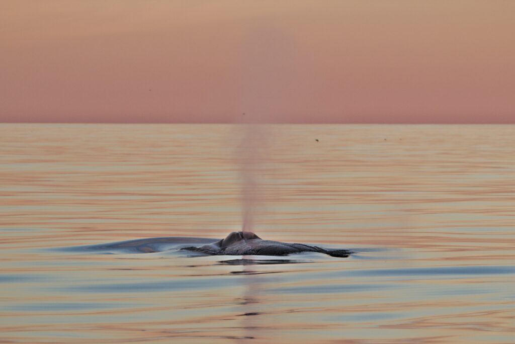
A humpback whale fluking in the midnight sun. Photo by Tom Grove.
Part of the solution
Barba provides an incredible platform for research and has allowed scientists to study marine life in the most challenging parts of the Northeast Atlantic over the years. Therefore, when Andreas invited us to collaborate on Arctic Sense, we were ecstatic. As a whale research charity, our main focus is, unsurprisingly, whales. Therefore, the next step was to read the scientific literature about whale populations in the polar Atlantic, current research and their principal conservation threats. From this, we came to four main conclusions:
- Despite encouraging recovery from commercial whaling, most whale populations are still far from their pre-exploitation size. Bowhead whales are perilously close to extinction in Svalbard. Northern bottlenose whales are largely gone from this former stronghold. Blue whales are returning but very slowly.
- We know remarkably little about whale populations in Svalbard waters. Where are the hotspots for bowheads and blues? Where do Svalbard blue whales migrate from? How do all species use this area over space and time to feed?
- Humans have a very clear footprint in Svalbard waters. Food chains are demonstrably responding to climate change. Plastic pollution is rife along coastlines and omnipresent as micro-particles in the water. Cacophonous seismic surveys for oil and gas persist throughout summer to the west. This is a hotspot for whales but not a haven from humans.
- The future is now and the future is crucial. We were especially interested in vessel traffic, which may traverse Svalbard waters and is projected to rise exponentially in the coming years and decades. The Polar Silk Road may not yet fully exist, but we can guess that its impacts could be severe on whale populations.
All together, we saw an opportunity. Barba can significantly improve our understanding of whale occurrence and distribution in Svalbard waters. We can understand how cetaceans use the area over space and time to feed and communicate. We may even determine a migration route for the largest animal on Earth. This information can feed into marine spatial planning. By mapping out key areas for threatened species, we can advocate for legal protection of these areas against large vessels and other human activity. Minimising climate change impacts is more complex and challenging, but all threats are interconnected. Limiting their cumulative effects may make the difference between extinction and survival. Therefore, we aim to explore the area for whales, understand the importance of these habitats and predict the future impact of human activity. This is the Arctic Sense we hope to provide.
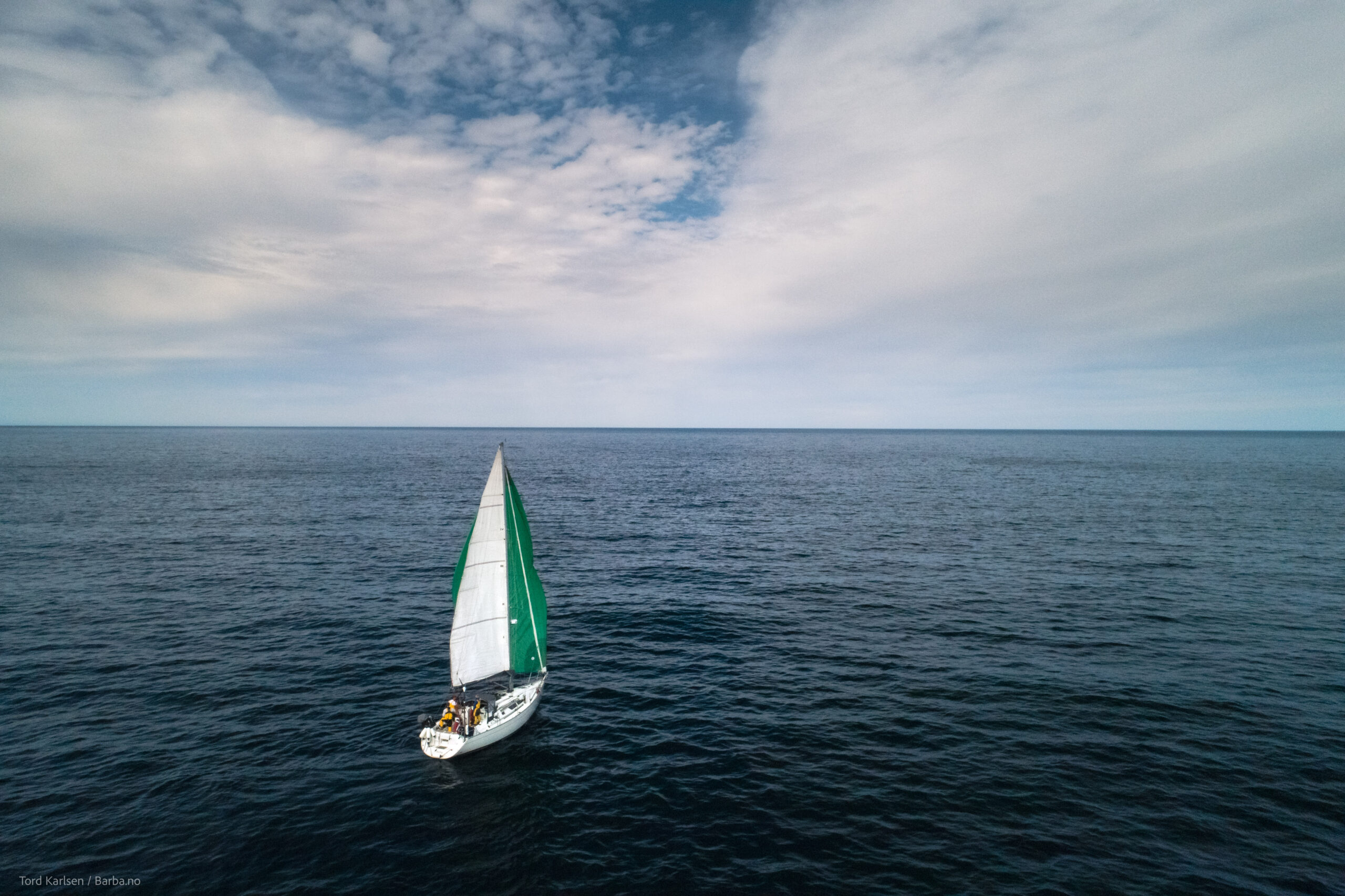
Barba on its way to Svalbard. Photo by Tord Karlsen.
The methods
To address these knowledge gaps (and more), we have organised four main research projects in Svalbard waters, each with its own methods and aims. We will describe each in detail over the next few blogs, but to give you a quick flavour …
- Aerial imagery. Despite a relatively ‘simple’ method, we are perhaps most excited about this project. We will use a drone to capture aerial images of baleen whales (mostly humpbacks) in Svalbard waters. From these, we can measure the length and body condition (aka blubber storage) of individual whales. This will provide clues as to how these whales use the area for feeding and energy storage. We will then compare these data with an identical study in Iceland, run by our field team, to determine differences in habitat use between feeding grounds. Finally, we will use historical whaling data (obtained from the International Whaling Commission) to determine any populations shifts in size and body condition over hundreds of years.
- Towed hydrophone array. From previous blogs, you may have already heard about Barba’s custom-built towed hydrophone array. This system will be paired with PAMGuard software to detect vocalising whales in real-time and store continuous acoustic data. This complex set-up addresses a simple but fundamental question: how are cetaceans distributed in Svalbard waters? The importance for marine spatial planning is clear.
- SoundTrap deployment. The towed array is perfect for surveying a large area in a snapshot of time. However, monitoring a single location over a period of time is also important to understand the occurrence and habitat use of whales. Therefore, we will deploy a hydrophone (SoundTrap ST500) southwest of Spitsbergen for the duration of this leg (two months). The area may be a hotspot for feeding baleen whales but, due to a lack of survey effort, has not yet been confirmed. Blue whales are of particular interest and, by characterising the call types of individual blues, we may even be able to determine their migratory origin.
- Aerial plastic surveys. Whales are our main target and passion, but their environment is just as important. Since Barba provides the ideal platform, we will take the opportunity to conduct plastic surveys of Svalbard coastlines, using a drone to improve efficiency and coverage. We are especially interested in assessing changes in the form and extent of plastic pollution since the Covid-19 pandemic.
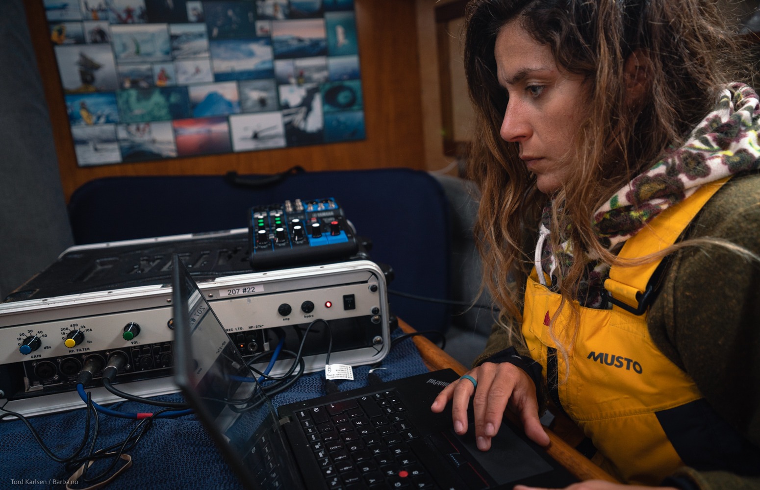
Giulia using PAMGuard to listen to whale species. Photo by Tord Karlsen.
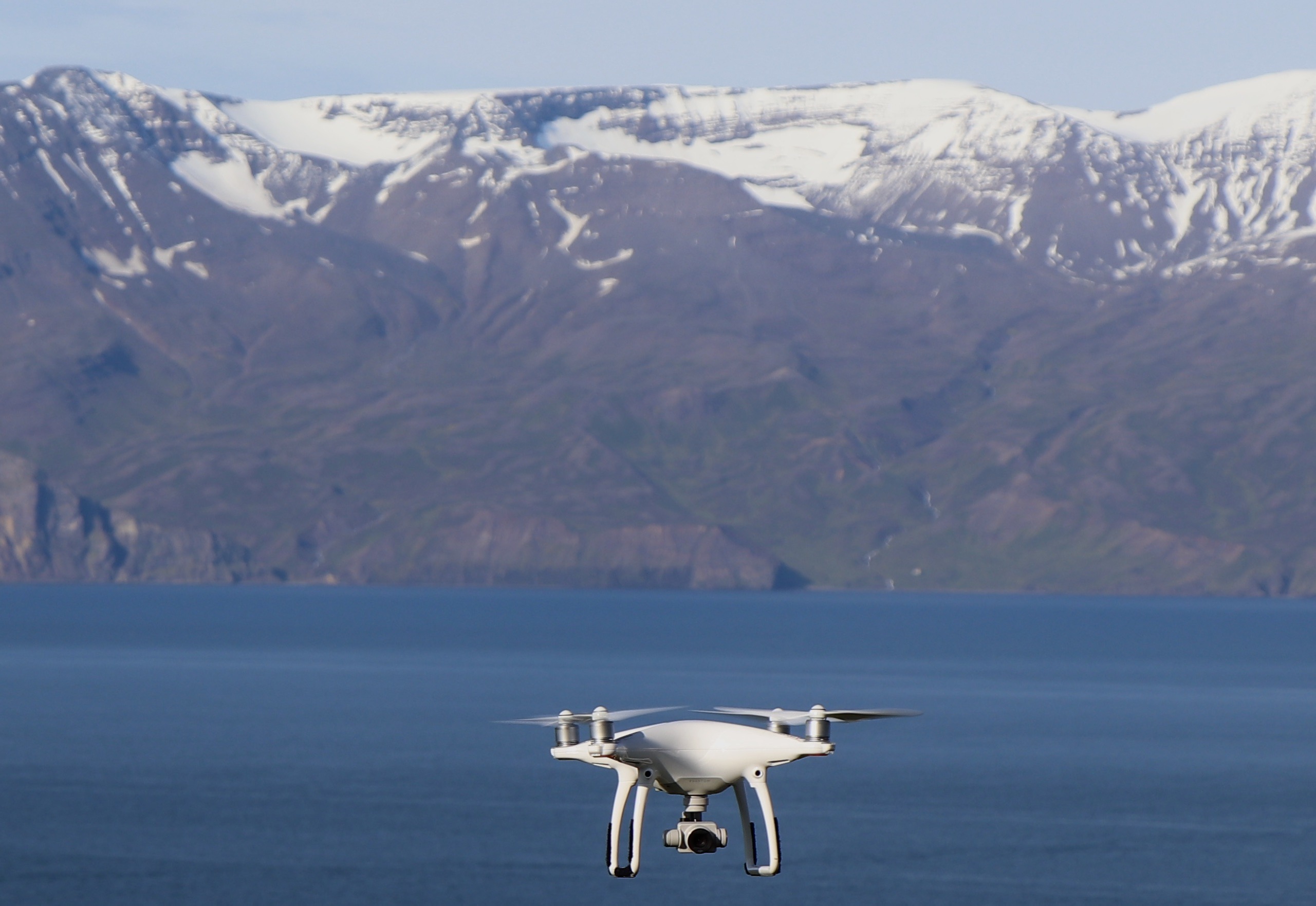
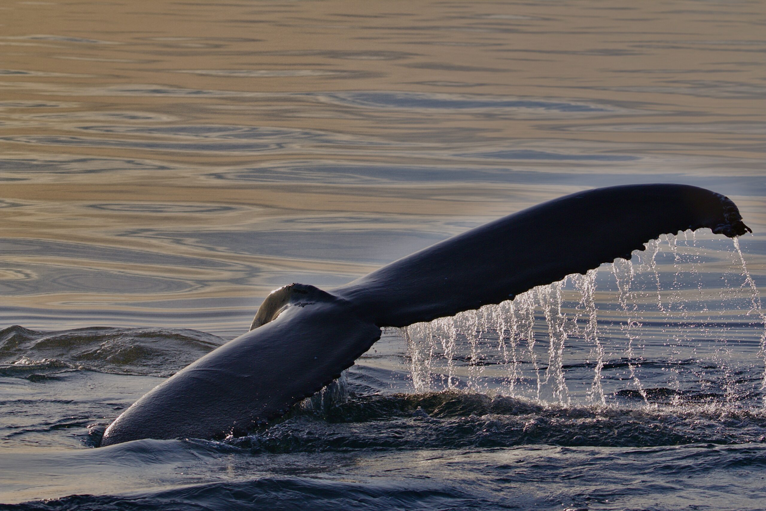
Drone hovering over the ocean, preparing to capture aerial images of baleen whales. Photo by Tom Grove.
Such a body of work could not be achieved without extensive collaboration with explorers and scientists alike. On board, our research will be run by Giulia Ercoletti, a cetacean researcher with acoustics experience and the newest member of the Whale Wise team! We are also grateful to:
- Petr Slavík (University of St. Andrews) MSc student and Whale Wise team member
- Marianne Rasmussen (University of Iceland) part of Arctic Sense’s scientific team
- Jonathan Gordon (University of St Andrews; Marine Ecology Research Limited), who built the hydrophone array and guided its deployment and PAMGuard setup.
- Chris Zadra (Ocean Alliance), who provided key equipment and expertise for our drone fieldwork
- Olli Loisa (Turku University of Applied Sciences), who has provided the acoustic release system for the SoundTrap deployment
- Kit Kovacs (Norwegian Polar Institute), for advice and local whale knowledge
All in all, the Barba crew is set to have an incredible two months of exploration and data collection. As they conduct the fieldwork, we will provide onshore support and start processing data. Stay tuned for our research adventures!
Featured image by Tom Grove
